
Article
Rewriting the 15th Century: A New History of Singapore and the Rise of Melaka
13 October 2026
Topics
History
One of the authors of the new edition of "Seven Hundred Years: A History of Singapore" explains how Malay sources, Portuguese texts and Chinese Ming records offer new perspectives on the decline of Temasek and the rise of the Melaka Sultanate.
By Peter Borschberg
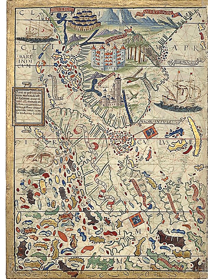
The “Chinarum Insule” map of Maritime Southeast Asia from the Miller Atlas is a highly detailed nautical chart created around 1519 by cartographers Pedro Reinel, Jorge Reiner and Lopo Homem, and illustrator António de Holanda. This is a section from the map showing the Malay Peninsula and Indochina. Both “Malaqua” and “Mabaqua” on the map refer to Melaka. From Bibliothèque Nationale de France.
For generations, the 15th century has occupied an uncertain place in Singapore’s longer history, treated as an interval between the trading settlement of Temasek mentioned in the Javanese epic poem Nagarakretagama (c. 1365) and Raffles’s founding of modern Singapore in 1819.
The third, fully revised edition of Seven Hundred Years asks new questions of the surviving evidence.1 The second chapter of the book traces the connections between Singapore and Melaka as successive stages in a wider transformation across the Malay world.
Redefining the 15th Century
Earlier accounts of Melaka’s founding have emphasised its strategic location, founder Parameswara’s migration and Chinese recognition. This new edition asks how Melaka’s rulers built and sustained the polity and what role Singapore played in that process, including what became of it.
Approached from that angle, the 15th century acquires a different dynamic. Melaka no longer appears fully formed, ready to assume its place as the dominant port of the Straits region. Instead, readers encounter a process of construction that began with the decline of Temasek-Singapura and culminated in the emergence of a new maritime centre. Singapore is no longer presented as a predecessor eclipsed by a more successful rival. It becomes the point of departure for understanding how Melaka acquired the political relationships, commercial networks and diplomatic experience that underpinned its later success.
One of the book’s most innovative approaches lies in its treatment of the evidence. Histories of early Melaka have been dominated by a limited documentary tradition. Some scholars have privileged the Sulalat al-Salatin (Genealogy of Kings), or Malay Annals, as the definitive local account of its origins, while others have relied on the Portuguese chroniclers of the 16th century. Still others have looked to Ming records – Ming Shi-lu (明實錄; Veritable Records of the Ming Dynasty), a collection of annals about the emperors of Ming China (1368–1644).
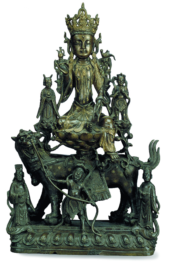
Singapore probably received its epithet of “Lion City” because the lion was an auspicious symbol of Buddhism practised in 14th-century Southeast Asia. The "Sulalat al-Salatin"’s descriptions of Sri Tri Buana (Sang Nila Utama) suggest he was consecrated as an incarnation of a Bodhisattva, probably the Amoghapasa form of Avalokitesvara, so justifying his claim to rulership over the Malays, who had yet to convert to Islam. As an incarnation of Avalokitesvara, he would have been seated on a lion throne or singhasana, as depicted in this 13th–14th-century Chinese figure, in gilt bronze with silver inlay, of Guanyin, the Chinese form of Avalokitesvara. Collection of the Asian Civilisations Museum.
The chapter reads Malay, Portuguese and Chinese sources alongside one another without privileging any single tradition as inherently authoritative. It recognises that each was produced for different purposes and preserves a different facet of the same historical transformation.2 Such an approach has become possible only through changes in the available source base and the sustained linguistic work required to bring these materials into dialogue.
The present revision draws more systematically on Tomé Pires’s Suma Oriental, new translations of relevant passages from João de Barros’s Décadas da Ásia (Decades of Asia) and Brás de Albuquerque’s Comentários do Grande Afonso de Albuquerque (Commentaries of the Great Afonso de Albuquerque), and the Italian letters of Giovanni da Empoli, which were not considered in earlier editions.
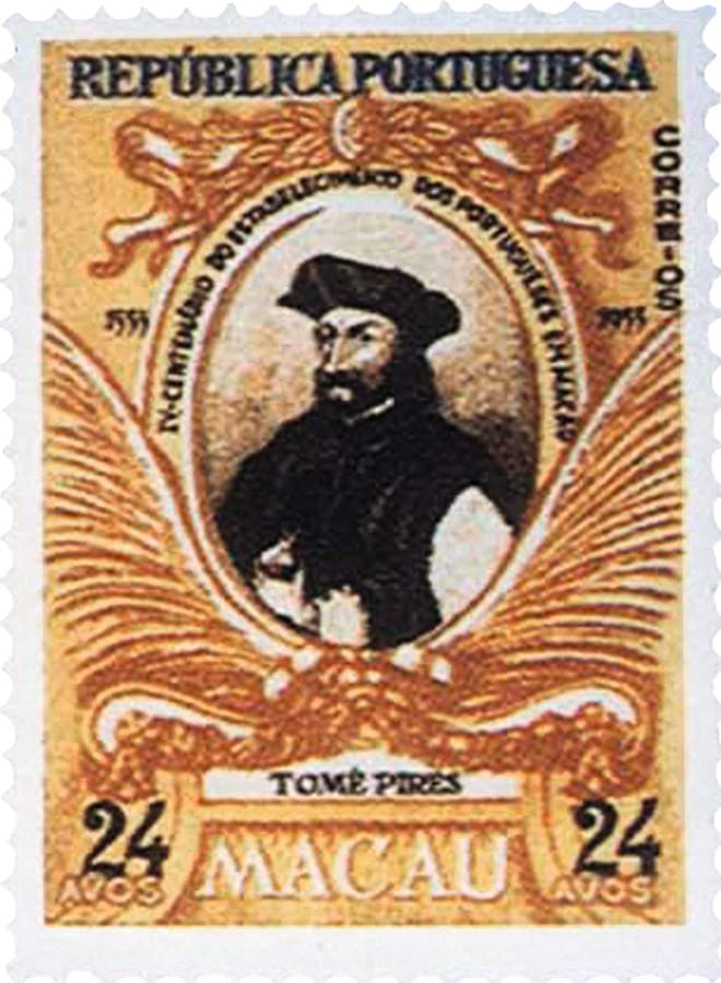
Portuguese Macau postage stamp of the Portuguese apothecary and chronicler Tomé Pires, 1955. His "Suma Oriental" (Summary of the Orient, c. 1513) is the oldest and most extensive account of the Portuguese East at the beginning of the 16th century. From Wikimedia Commons.
The challenge lies not simply in locating additional texts, but in reading materials written across distinct textual traditions, political vocabularies and authorial purposes. No single language or archive preserves the whole story. Yet the principal obstacle was also historiographical: the inherited assumption that little more remained to be recovered about Singapore during the Melaka Sultanate discouraged precisely the questions that have now made this chapter possible.
The Sulalat al-Salatin, an important literary work composed in its most familiar form anchored in Raffles Ms. 18 (this manuscript is based on the earliest version of the text and likely transcribed for Stamford Raffles) around the early 17th century, is concerned, above all, with the moral foundations of kingship. It seeks to explain what made a ruler legitimate, why kingdoms prospered or declined, and what obligations united ruler and subject. Its account of Singapore’s downfall is not primarily an exercise in chronology but an exploration of political ethics.
The humiliation of Sang Rajuna Tapa’s daughter becomes the decisive breach of the covenant established between Sri Tri Buana (or Sang Nila Utama, believed to be the Srivijayan prince from Palembang who founded the city of Singapura on the island of Temasek around 1299) and Demang Lebar Daun (the chief of Palembang). The people promised to be loyal to the king, and in return Sri Tri Buana promised that the rulers would never publicly shame, humiliate or oppress their subjects. Sang Rajuna Tapa was the state treasurer of Singapura under Sultan Iskandar Shah, its fifth and final ruler.
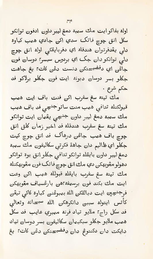
According to the Sulalat al-Salatin, the ruler of Palembang, Demang Lebar Daun, concluded a covenant with Sri Tri Buana which stated that in return for the undivided loyalty of his subjects, Sri Tri Buana and all his descendants would be fair and just in their rule. This extract is from the 1840 edited version by Abdullah bin Abdul Kadir (Munsyi Abdullah) published under the title Sejarah Melayu. Collection of the National Library of Singapore (Accession no. B31655050C).
When Sang Rajuna’s beautiful daughter became the sultan’s favourite concubine, the other jealous consorts framed her for infidelity, which led her to be publicly executed. Angered by this, Sang Rajuna sent a message inviting the Majapahit Empire of Java to invade Singapura. Iskandar Shah and his followers fled north and he eventually founded Melaka. The destruction of Singapura happened because the moral order of the kingdom had been compromised.3 The narrative is less interested in military events than in explaining why legitimate authority was undermined.
The Portuguese sources, on the other hand, were shaped by a very different set of concerns because they emerged from the circumstances of conquest in 1511. During the decade following the capture of Melaka, Portuguese officials, merchants and chroniclers found themselves responsible for administering what had been one of the wealthiest commercial centres in Asia. They had taken a remarkably successful port-polity but possessed only a limited comprehension of how it functioned. To govern Melaka effectively, they needed to understand the political and commercial machinery they had taken over.
That understanding was acquired not in Europe but in Melaka itself. The Portuguese lived among the very people who had sustained the sultanate’s success. They spoke with those who remained after the conquest, as well as with Gujarati, Tamil, Javanese, Chinese, Arab and Persian traders, harbour officials, pilots, interpreters and visitors from neighbouring kingdoms. Their histories grew out of conversations, negotiations and enquiries conducted in the years immediately following the conquest. The Portuguese narratives therefore preserve far more than European observations. They also record, albeit through Portuguese mediation, the collective historical memory of Melaka’s neighbours, allies, merchants and officials.
, drawn by an unknown Portuguese cartographer in 1.jpg)
The Cantino planisphere (or Cantino world map), drawn by an unknown Portuguese cartographer in 1502, is the oldest surviving map to document early Portuguese geographical discoveries in the Eastern and Western hemispheres. The map is preserved at the Biblioteca Estense Universitaria in Modena, Italy. From Wikimedia Commons.
This explains why the Portuguese texts ask questions that do not appear in the Sulalat al-Salatin. They seek to understand how Parameswara acquired power, why he abandoned Singapore, how Melaka secured the support of the Orang Laut (communities of the sea), why merchants preferred its harbour, how alliances were maintained, how customs were collected and how commercial confidence was built and cultivated across a diverse trading community. Their concerns focus on the practical construction and maintenance of a successful maritime polity. Simply put, the Portuguese sources explain what made Melaka tick and how it worked.
The Chinese records shed light on a third dimension of that story. Their principal concern was neither the ethics of kingship nor the practical operations of commerce, but the incorporation of new polities into the diplomatic framework of the Ming empire. They provide the most detailed chronology for many events while revealing the importance that Melaka attached to imperial recognition and tributary diplomacy.4 Read alongside the Malay and Portuguese traditions, Chinese sources show how international standing and legitimacy formed part of Melaka’s political strategy rather than a ceremonial afterthought.
Each of these archives therefore answers different sets of questions. The Malay texts explain legitimacy, the Portuguese accounts explain politico-economic construction and sustenance, and the Chinese documents explore chronology and diplomacy. Considered individually, each offers only a partial view, but read in unison they reveal something far greater.
The chapter does not attempt to harmonise differences between the sources or identify a single authoritative tradition. Instead, it treats those differences as historically meaningful because they reflect the concerns of the societies that produced them. The outcome is a more differentiated reconstruction of Singapore and Melaka than has generally appeared in earlier histories.
Revisiting Melaka’s Origins
The chapter’s reinterpretation of Melaka’s origins follows the same logic. Past accounts generally present the city as the product of a foundational moment: the encounter with the mouse-deer (sang kancil)5 beneath the Melaka tree and the founding of Melaka that followed. Whatever its symbolic value, the story compresses a longer process into a single dramatic episode. The new chapter recovers another and arguably older narrative that has gradually receded from view.
A century ago, the origins of Melaka became the subject of one of the great historiographical debates in Southeast Asian history. It began with Gabriel Ferrand (1864–1935), the distinguished French Orientalist, diplomat and authority on the Indian Ocean world, whose pioneering studies of Arabic, Persian and European geographical texts sought to reconstruct the early history of maritime Asia. In a book published in 1918, Ferrand argued that Melaka’s origins reached much further back than generally assumed. He thought he had identified references in texts which pointed to an established settlement well before the 1400s. His bold thesis immediately attracted attention and raised fundamental questions about the relationship between Singapore and Melaka.
Ferrand’s arguments provoked an extraordinary response from Gerret Pieter Rouffaer (1860–1928), one of the Netherlands’ foremost scholars of the Indonesian archipelago and an authority on Javanese and Sumatran history. Rouffaer originally intended to write a brief 20-page review. Instead, he produced a monumental study exceeding 400 pages. Before one could understand the origins of Melaka, Rouffaer contended, one first had to reconstruct the history of Temasek-Singapura itself. The debate consequently expanded far beyond the dating of Melaka’s foundation and became an enquiry into the transformation of the entire southern Malay world.6
Although Rouffaer rejected Ferrand’s historical conclusions, he came to recognise something of much greater and more enduring importance. The Malay and Portuguese source traditions preserved a pattern of migration. The founders of Melaka did not suddenly appear on the west coast of the peninsula. Their story unfolded through successive stages stretching from Java or Palembang to Singapore, then onwards through Muar before finally reaching Bertam and Melaka. The history of Melaka is therefore deeply intertwined with that of Singapore.
![Printed engraving of a “Melaya Captain” leading a group of armed Orang Laut, in Johan Nieuhof’s Embassy from the East India Company, printed in 1669. Image reproduced from Johan Nieuhof, Voyages & Travels to the East Indies, 1653–1670 (Singapore: Oxford University Press, 1988), 27. Collection of the National Library of Singapore (Call no. RCLOS 915.98 NIE-JSB]).](https://isomer-user-content.by.gov.sg/339/6afb0451-da0f-4c27-9004-12f9823d2179/Printed engraving of a “Melaya Captain” leading a group of armed Orang Laut, in Johan Nieuhof’s.jpg)
Printed engraving of a “Melaya Captain” leading a group of armed Orang Laut, in Johan Nieuhof’s Embassy from the East India Company, printed in 1669. Image reproduced from "Johan Nieuhof, Voyages & Travels to the East Indies, 1653–1670" (Singapore: Oxford University Press, 1988), 27. Collection of the National Library of Singapore (Call no. RCLOS 915.98 NIE-JSB]).
Although Rouffaer’s reconstruction gradually entered the historiography, its wider implications were seldom explored. The migration sequence became accepted as background while scholarly attention shifted towards questions of chronology, Islamisation and the historical identity of Parameswara.
The new chapter restores migration as one of its central tenets of this chapter. Rather than treating movement as a prelude to Melaka’s foundation, it asks what migration itself accomplished. The answer extends well beyond the relocation of a royal household. Rulers travelled with followers, merchant communities, Orang Laut alliances, diplomatic experience and established practices. Authority itself proved mobile because it rested on relationships rather than territory. Seen from this perspective, Melaka did not emerge from a single act of foundation beneath a tree. It developed through the gradual transplantation and recombination of an order whose immediate antecedent lay in Singapore and whose deeper roots reached back to Palembang.
Reframing Singapore’s Decline
The chapter’s reinterpretation of Melaka’s origins is matched by an equally important reassessment of Singapore’s decline. Conventional histories have generally explained the decline of Temasek-Singapura in relatively straightforward terms. The polity succumbed to attack, whether from Majapahit, Siam or some combination of external forces, and its significance disappeared abruptly. Melaka then inherited Singapore’s commercial role and assumed its place as the principal maritime centre of the Straits. The transition appears neat and decisive.
The new chapter presents a considerably more complex picture. The fall of Singapore was not a single event but the culmination of interacting processes. More importantly, the source traditions explain those processes in strikingly different ways. Once again, the differences between them are treated not as contradictions that can be ignored but as evidence that authors in the deeper past understood the crisis from different vantage points.
Within the Sulalat al-Salatin, Singapore’s destruction is first and foremost a political and moral catastrophe. The ruler, as stated earlier, violated the covenant established between Sri Tri Buana and Demang Lebar Daun. The subsequent betrayal of the kingdom is presented not as an isolated act of treachery, but as the consequence of a ruler who has abandoned the ethical foundations of kingship. Military defeat completed a process that had already begun. Legitimate authority collapsed before the city itself fell.
The Portuguese narratives are concerned with political ambition, shifting alliances and strategic calculation. Parameswara appears not as a moral exemplar but as an ambitious political actor operating within a competitive environment. He establishes himself in Singapore, seizes power, cultivates support and eventually abandons the settlement when confronted by a powerful Siamese expedition, probably reinforced with help from Patani. Questions of diplomacy, maritime security, commercial opportunity and rivalry dominate the narrative in place of moral judgement.
Neither explanation is rejected, nor is either privileged. The Malay texts highlight the indigenous language through which legitimacy was understood, while the Portuguese preserve contemporary explanations of strategy and statecraft. Read together, they suggest that Singapore’s decline resulted from an interaction between internal fracture and external geopolitical pressures.7
The city’s fall appears neither inevitable nor instantaneous. It unfolded through a succession of decisions that weakened an already fragile order before external intervention brought the experiment to an end.
This reinterpretation also alters the relationship between Singapore and Melaka. If Singapore collapsed solely because it was attacked and defeated, then Melaka naturally became its replacement. If, however, Singapore’s decline involved the erosion of authority while many of its relationships, commercial networks and maritime alliances survived, depending on the sources, the Majapahit or Siamese attack, then Melaka began to look less like a successor than an inheritor. The continuity thus lies not in territory but in people, connections, practices and experience.
A History Built Through Relationships
This emphasis on continuity leads directly to one of the chapter’s central arguments. Neither Singapore nor Melaka is explained primarily through geography. Historians have long pointed to Melaka’s strategic location astride one of the world’s busiest maritime corridors, and with good reason. Yet favourable geography alone cannot explain why one settlement became a very significant centre in Asia while many others occupying equally advantageous positions remained comparatively insignificant.
The chapter argues that Melaka’s success also rested on relationships. Its rulers assembled a system in which different forms of authority reinforced one another. Support from the Orang Laut enhanced maritime security. Maritime security encouraged merchant confidence. Merchant confidence attracted greater volumes of trade, increased prosperity and strengthened the ruler’s prestige. Greater prestige facilitated diplomacy with regional powers and enhanced Melaka’s standing within the regional tributary structures. Each relationship reinforced several others, creating a cumulative process through which commercial success and authority developed together.
Importantly, none of these relationships emerged in isolation. Melaka did not invent the techniques on which its success hinged. Maritime peoples had long been incorporated into royal service elsewhere in the Malay world. Merchant communities had long been encouraged through privileges and commercial protections. Diplomatic marriages, tributary relationships and negotiated alliances had deep historical roots. What distinguished Melaka was not institutional novelty but the effectiveness with which its rulers combined inherited practices into a coherent and durable order.
Migration thus becomes significant well beyond movement from one place to another. Melaka’s founders carried with them much more than a court and its immediate followers. They transferred commercial connections, maritime alliances, diplomatic experience and established expectations about how authority should be exercised. The migration from Palembang through Singapore to Melaka was simultaneously the migration of an accumulated repertoire.
This emphasis on ruler agency represents another key departure from earlier interpretations. Explanations centred on geography, commerce or Chinese protection tend to reduce leadership to a secondary role. The chapter reverses that relationship. Geography created opportunities, but opportunities still had to be recognised and exploited. Commercial prosperity depended on confidence, confidence depended on security and security depended on judgement. Melaka’s rulers became entrepreneurs who consciously assembled and maintained the relationships upon which their polity’s prosperity rested.
 plotting the passage of Zheng He’s fleet past Longyamen (Dragon.jpg)
Section of the Mao Kun Map (茅坤图) plotting the passage of Zheng He’s fleet past Longyamen (Dragon’s Teeth Gate). The Mao Kun Map is the collective name for a set of navigation charts purportedly based on the 15th-century expeditions of the Indian Ocean by Ming-dynasty explorer Admiral Zheng He (郑和). Danmaxi (淡马锡; Temasek) is shown on the top left of the map. Collection of the National Library of Singapore (Accession no. B26078782G).
Underlying these arguments is a broader historiographical shift. For much of the past century, historians sought to classify Melaka according to one political model or the other. The new chapter instead directs attention towards the practical problems confronting its rulers. How does a displaced ruler establish authority in a new environment? How are merchant communities persuaded to relocate? How are alliances forged across diverse ethnic and political communities? How is maritime security maintained?
These questions shift the focus from classification to construction. Melaka no longer appears as the almost inevitable outcome of favourable geography or expanding regional trade. It emerges through a succession of choices, each addressing problems while creating new opportunities. The history of the 15th century thus becomes less a catalogue of institutions than an account of creativity in action.
A Different 15th Century
One of the chapter’s most important intellectual debts is to Anthony C. Milner’s seminal work on the Malay kerajaan (Malay for “government” or ‘kingdom”). Milner, one of the world’s leading scholars of Malay history and political culture, wrote that European notions of the “state”, defined by territorial boundaries and permanent institutions, sit uneasily with the realities of the pre-modern Malay world. Allegiance attached to persons more readily than to places, while power radiated outwards through networks of loyalty whose strength varied according to circumstance. The chapter accepts this insight but asks an additional question that has received suprisingly sparse attention: If rulers occupied the centre of the political system, what did successful rulers actually do?8
Successful rulers emerge not just as figures embodying legitimate authority, but as active builders of order. They negotiated alliances with neighbouring courts, cultivated the loyalty of the Orang Laut, reassured merchants that justice and security would prevail, strengthened diplomatic links with other polities and balanced competing regional interests. Merchant communities did business in Melaka because they saw that agreements would be honoured, commerce protected and disputes resolved fairly.
This emphasis transforms the way Melaka’s success can be understood. Melaka prospered because successive rulers recognised opportunities, assembled durable alliances and successfully combined inherited practices into a resilient system. Their achievement rested on sound judgement exercised over generations.
Seen from this perspective, the 15th century acquires a very different rhythm. Traditional histories often present the period as a sequence of established kingdoms succeeding one another starting with Srivijaya. Each polity appears almost fully formed before yielding its place to the next. Such narratives conceal the uncertainty and negotiation through which political communities were actually created.
The chapter foregrounds those processes to explain why Singapore unconventionally occupies such a prominent place within the chapter. The island becomes the principal setting in which many of the relationships, commercial practices and diplomatic habits that would later characterise Melaka were assembled, tested and refined. The significance of Singapore therefore lies not simply in its existence as a port, but in its role as a laboratory of experience whose legacy travelled with those who eventually established Melaka.
The chapter proposes a different way of writing the history of the Singapore and Melaka Straits region by placing relationships at the centre of historical explanation. Instead of presenting migration as disruption, it understands mobility as one of the defining characteristics of maritime political life. It demonstrates how diplomacy, commerce, maritime security, legitimacy and recognition interacted to reinforce one another. And it allows Malay, Portuguese and Chinese sources to shed light on different facets of the same historical transformation.
The cumulative effect is to restore the 15th century to its proper place within Singapore’s history. It now emerges as one of the most creative periods in the island’s past, when an older tradition was reconfigured into a new maritime order that would dominate the Straits for well over a century.
This is what differentiates the new chapter from earlier accounts. Its originality lies in the questions it asks of evidence that has long been available. By shifting attention to the processes through which order was constructed, it reconnects Singapore and Melaka within a single historical narrative. In this way, the rise of Melaka and the decline of Singapore cease to be separate stories.
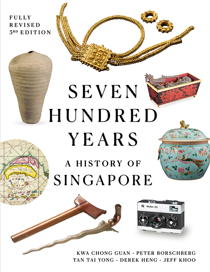
Seven Hundred Years- A History of Singapore
The third edition of Seven Hundred Years: A History of Singapore (fully revised and updated) will be published in early 2027. The book will be available for reference at the Lee Kong Chian Reference Library (RSING 959.57 KWA-[HIS]), for loan at selected public libraries (SING 959.57 KWA-(HISI), and for sale at physical and online bookstores.
About the Author
Dr Peter Borschberg is co-author of Seven Hundred Years: A History of Singapore (2nd and 3rd editions). He is an award-winning historian of the early modern period who has published widely on the history of Singapore and its region, global history and globalisation, and maritime history and Europe–Asia interaction in the period 1300–1900.
End Notes
1 The second edition was published in 2019. See Kwa Chong Guan, Derek Heng, Peter Borschberg and Tan Tai Yong, Seven Hundred years: A History of Singapore (opens in new tab) (Singapore: National Library Board and Marshall Cavendish International, 2019). (From National Library of Singapore, call no. RSING 959.57 KWA-[HIS])
2 The principal texts include C.C. Brown, ed. and trans., “Sĕjarah Mĕlayu or ‘Malay Annals’,” Journal of the Malayan Branch of the Royal Asiatic Society 25, nos. 2–3 (October 1952): 5–276, especially 26–31 and 50–51. (From JSTOR via NLB’s eResources (opens in new tab) website); Tomé Pires, The Suma Oriental of Tomé Pires: An Account of the East, from the Red Sea to Japan, Written in Malacca and India in 1512–1515 (opens in new tab), ed. and trans. Armando Cortesão, 2 vols. (London: Hakluyt Society, 1944), 2: 230–45. (From National Library of Singapore, call no. RRARE 910.8 HAK); João de Barros, Decada Secunda da Asia de Ioão de Barros: Dos feitos que os Portugueses fezerão no descobrimento & conquista dos mares & terras do Oriente (Em Lisboa: Impressa per Iorge Rodriguez, 1628), fols. 129v–130r, https://catalog.hathitrust.org/Record/009303331; and Brás de Albuquerque, Commentarios do grande Afonso Dalboquerquept (opens in new tab), 4 vols. (Lisbon: Na Regia Officina Typografica, 1774), 3:73–77. (From National Library of Singapore, call no. RRARE 946.902 ALB). For the notices concerning Melaka preserved in the Ming Shilu, see Geoff Wade, trans., Southeast Asia in the Ming Shi-lu: An Open Access Resource (Singapore: Asia Research Institute and Singapore E-Press, National University of Singapore, 2005), accessed 31 July 2026, https://epress.nus.edu.sg/msl/ (opens in new tab).
3 For the Malay account of the covenant, its violation through the public humiliation of Sang Rajuna Tapa’s daughter, and the resulting fall of Singapore, see Brown, “Sĕjarah Mĕlayu or Malay Annals,” 26–27, 50–51.
4 Wang Gungwu, “The Opening of Relations between China and Malacca, 1403–5,” in Malayan and Indonesian Studies: Essays Presented to Sir Richard Winstedt on His Eighty-Fifth Birthday, eds. John S. Bastin and R. Roolvink (London: Oxford University Press, 1964), 87–104. (NLB has the 1964 edition printed by Clarendon Press, call no. RCLOS 959.5BAS (opens in new tab)); and Wang Gungwu, “The First Three Rulers of Malacca,” Journal of the Malaysian Branch of the Royal Asiatic Society 41, no. 1 (213) (July 1968): 11–22. (From JSTOR via NLB’s eResources (opens in new tab) website)
5 Theresa Fuller, “The Different Faces of Sang Kancil,” BiblioAsia, 14 April 2026, https://biblioasia.nlb.gov.sg/all-sections/the-different-faces-of-sang-kancil/ (opens in new tab).
6 Gabriel Ferrand, Relations de voyages et textes géographiques arabes, persans et turks relatifs à l'Extrême-Orient du VIIIe au XVIIIe siècles (opens in new tab), 2 vols. (Paris: Ernest Leroux, 1913-1914). (From National Library of Singapore, call no. RCLOS 910.4 FER-[GBH]); G. Ferrand, Malaka, le Malayu et Malayur (Paris: Imprimerie Nationale, 1918); G.P. Rouffaer, “Was Malaka Emporium vóór 1400 A.D. genaamd Malajoer? En waar lag Woerawari, Ma-Hasin, Langka, Batoesawar?” Bijdragen tot de Taal-, Land- en Volkenkunde 77 (1921): 1–174, 359–604, https://brill.com/view/journals/bki/77/1/article-p1_1.xml (opens in new tab).
7 For the Malay account of the covenant between ruler and subject, and the resulting betrayal and fall of Singapore, see Brown, “Sĕjarah Mĕlayu or Malay Annals,” 26–27, 50–51. For the Portuguese text traditions, see Pires, The Suma Oriental of Tomé Pires (opens in new tab), 2: 230–36; Barros, Decada Secunda da Asia de Ioão de Barros, fols. 129v–130r; and Albuquerque, Commentarios (opens in new tab), pt. 3, 73–74.
8 Anthony C. Milner, Kerajaan: Malay Political Culture on the Eve of Colonial Rule (opens in new tab) (Tucson: University of Arizona Press, 1982), 94–116, especially 112–16. (From National Library of Singapore, call no. R 959.5103 MIL)