
Article
Lay of the Land: The National Archives of Singapore’s Map Collection
Topics
Collection Highlights
1 January 2015
From Singapore's days as a colony to modern times, maps have been an integral part of the nation's development. Kevin Khoo highlights the National Archives of Singapore's 10,000-strong map collection.
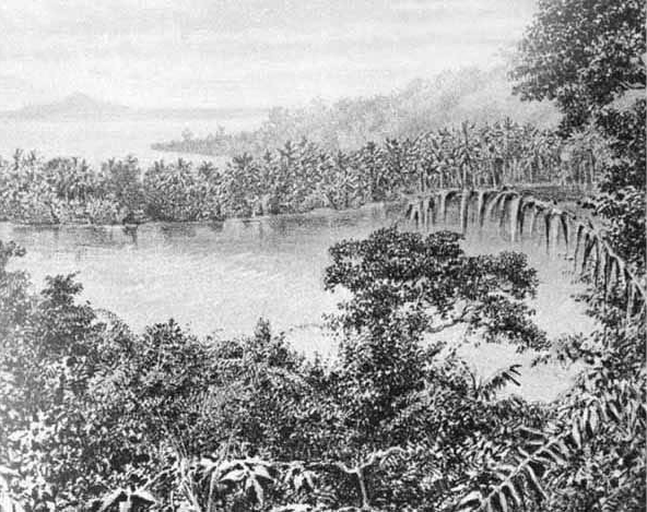
Illustration of entrance to Singapore's harbour in 1860. Nineteenth Century Prints of Singapore (Plate 37. Notes p. 98), National Museum of Singapore, 1987.
Among the various records under the care of the National Archives of Singapore (NAS) is a collection of some 10,000 maps that originate primarily from three government agencies – the Survey Division of the Singapore Land Authority (SLA), whose beginnings trace back to the Straits Settlements Survey Department formed in the mid-19th century; the Singapore Armed Forces Mapping Unit (SAFMU) formed in 1970; and the Maritime Port Authority (MPA) established in 1996 and its predecessor the Port of Singapore Authority (PSA; formed in 1964). The collection also contains copies of maps of Singapore acquired from overseas archives, notably the National Archives of the United Kingdom (NAUK) and the British Library, as well as maps from various private collectors.
The maps in the NAS collection fall into the following broad categories:
General Reference Maps
These maps show a variety of different physical features at a given location, such as coastlines, water bodies, vegetation, hills and mountains, roads, commercial, industrial, residential and recreational areas. These maps comprise two types: small-scale, covering large geographical areas such as whole countries or regions, or large-scale, covering a small geographical area but providing more detail on local physical features.1 The general reference maps in the NAS collection include maps of Asia and Southeast Asia, maps of Singapore town and island, various street maps and district or precinct maps. There are presently around 3,800 general reference maps in the NAS collection.
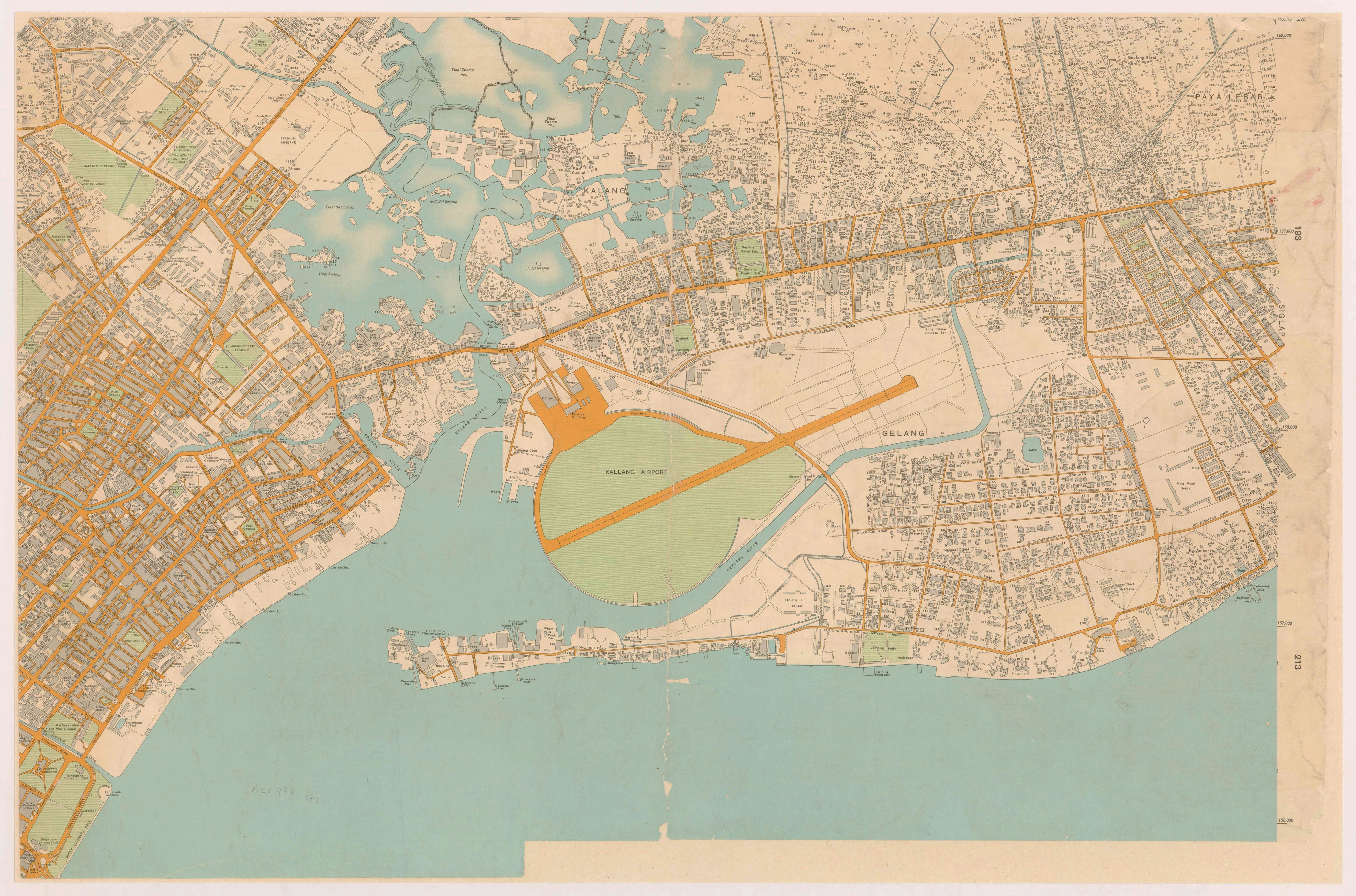
General Reference Map: A section from a six-part large-scale map, “Map of Singapore City, 1954”, covering Bugis, Kallang and Geylang. Survey Department, courtesy of National Archives of Singapore.
Topographic Maps
Topographic maps are a type of small-scale general reference map that includes accurately measured contour and relief details providing users with a reliable three-dimensional sense of the space being mapped. Such maps typically provide highly detailed information of the local environment and are generally the most comprehensive type of small-scale general reference map available. Singapore's first complete set of topographic maps was published in 1924 by the Survey Department of the Federated Malay States and Straits Settlements and, subsequently, many general reference maps of Singapore have included topographic details. There are presently around 1,300 topographic maps in the NAS collection.
Cadastral Maps
Cadastral maps are drawn up by state land-use authorities to document and demarcate parcels of physical property claimed by different property owners. These maps are used to establish property boundaries and legal claim over property as well as to estimate land values and assess property tax.2 As cadastral maps were traditionally used by the government to aid the tax collection process. they were sometimes referred to as "revenue maps". There are currently about 3,300 cadastral maps in the NAS collection.
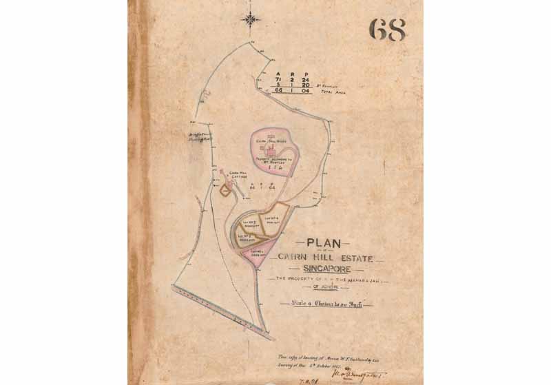
Cadastral Map: An 1887 map showing the boundaries of the Cairn Hill Estate owned by the Maharaja of Johor. Survey Department, courtesy of National Archives of Singapore.
Hydrographic Charts
These are sea navigation charts used by mariners to sail through open or near-shore waters. Such charts display features such as soundings (the depth of water at a given location), shoal waters, lights, key landmarks such as lighthouses and buoys, harbour approaches and anchorages, a compass rose to orientate the map and other information to aid navigation. Such maps are termed “charts” as they are not only meant to be looked at, but are also used as working material to be marked up by navigators in the course of their work. There are presently about 700 hydrographic charts in the NAS collection.
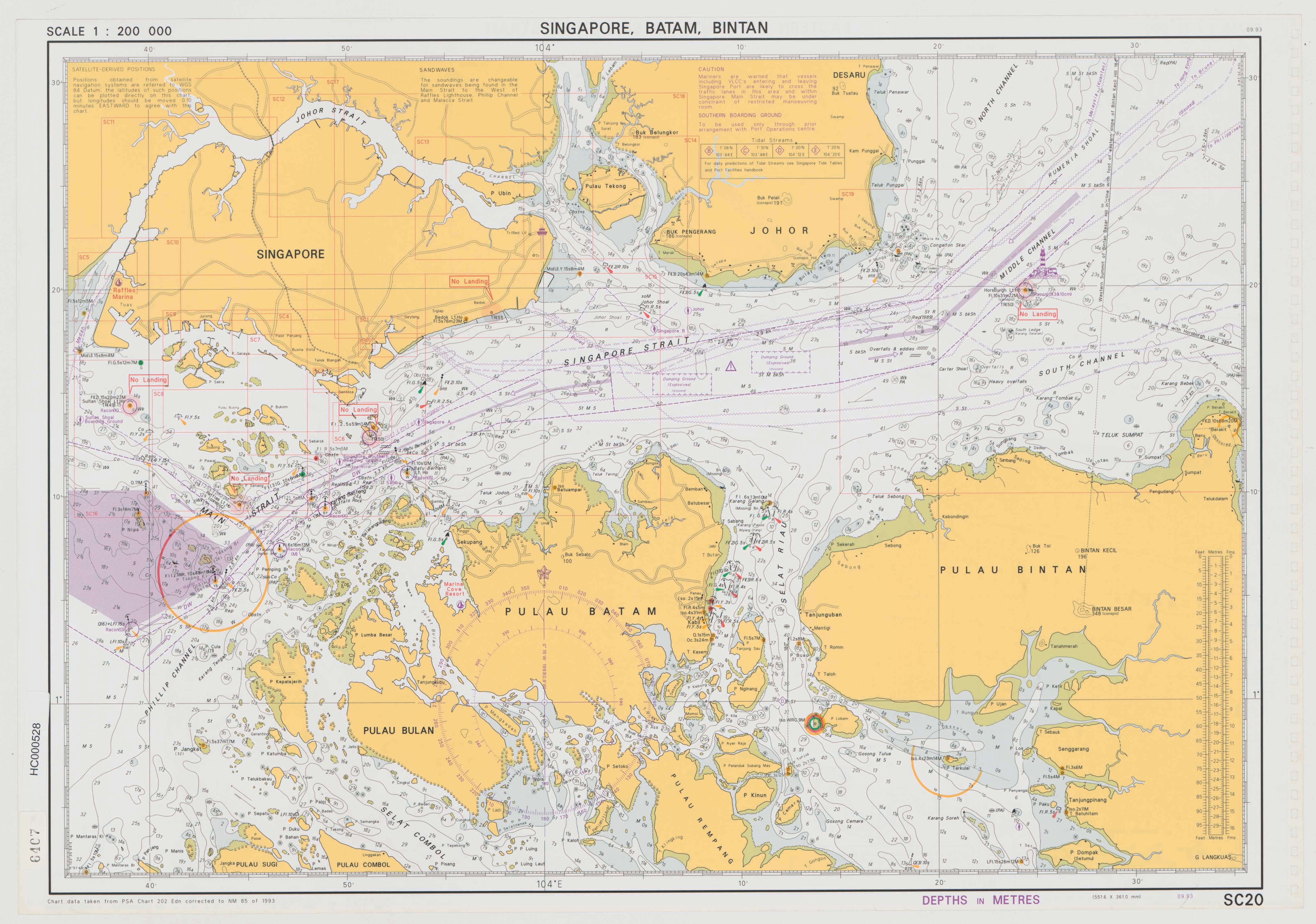
Hydrographic Chart: A modern hydrographic chart for small-craft navigating the waters around Singapore. Batam and Bintan islands. 1993. Port of Singapore Authority, courtesy of National Archives of Singapore.
Thematic Maps
These are special purpose maps typically overlaid with details specific to the concerns of the user, for example, mining, urban and transportation planning, soil and environmental information, flood and disease control, and military planning. NAS has a small collection of fewer than a hundred of such maps. However, many more thematic maps can be found embedded within archived government reports, files and publications where they are frequently used as supporting and illustrative documents.
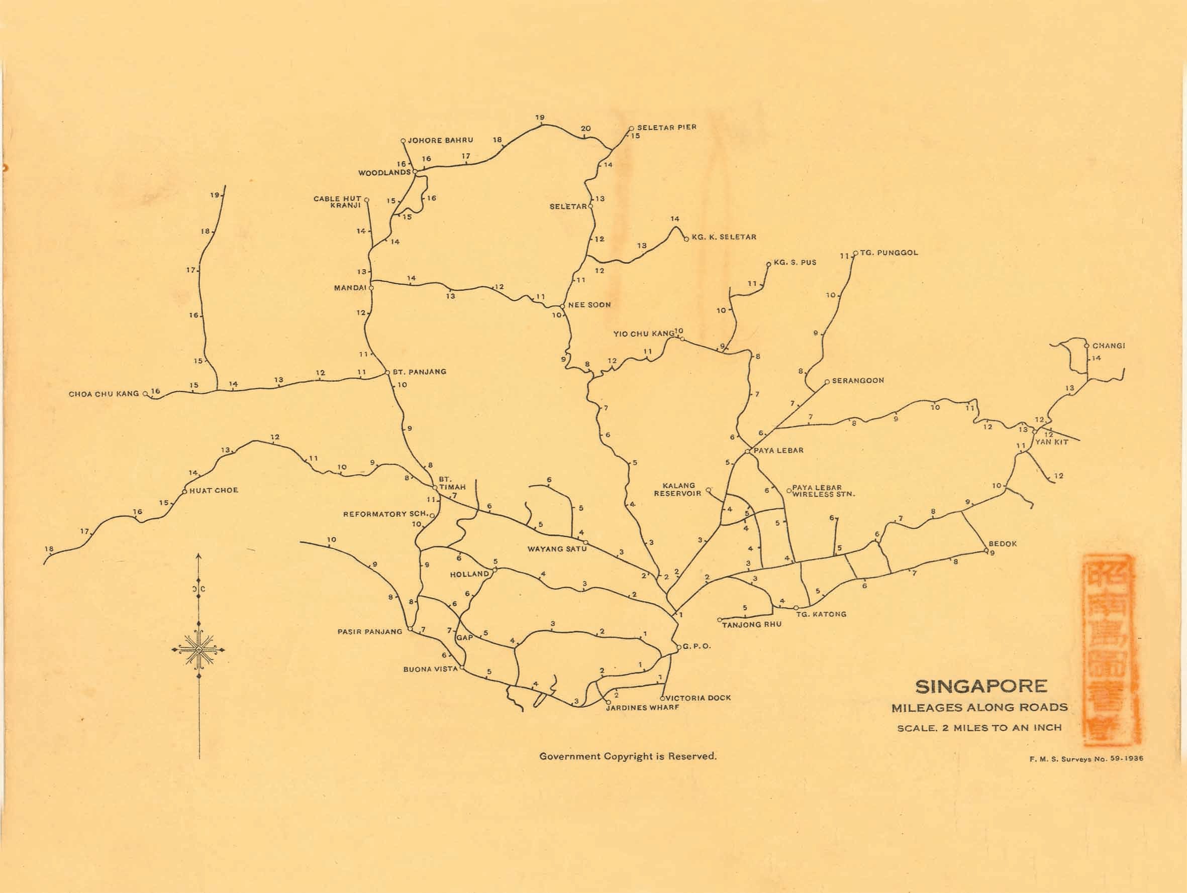
Thematic Map: "Singapore. Mileages Along Roads" was printed by the Federated Malay States Survey Department in 1936. This map measured the distance of key landmarks and districts across Singapore island. using the General Post Office in the Fullerton Building at Empress Place as its "zero-point". Survey Department, courtesy of National Archives of Singapore.
Geographical Variety
The vast majority of maps in the NAS collection (numbering over 8,000) are geographic maps of Singapore. These include maps of the island of Singapore and its surrounding waters, and of particular areas and districts of the island, notably the heavily populated town centre as well as outlying precincts like Katong, Jurong and Changi. In addition, the collection contains about 900 maps of Malaya dating to pre-1963. These maps illustrate the Malayan Peninsula, the seas around it and specific places such as the capital Kuala Lumpur and major towns such as Penang, Malacca and Johor. A small number of maps of Southeast Asia and wider Asia are also part of this collection.
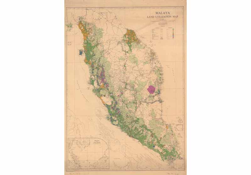
Geographical Map: A 1953 map showing land utilisation on the Malayan Peninsula and Singapore. Survey Department, courtesy of National Archives of Singapore.
Maps Spanning 190 Years: From 1819 to 2009
Fewer than 40 maps from the NAS collection are from the pre-1819 period before Singapore was founded. Most of these early maps date from the late 18th century to the early 1800s and are mainly of British as well as Dutch and Portuguese origins.
NAS holds about 190 maps from the early colonial period (1819–1866) when Singapore was administered together with Penang and Malacca as part of the Straits Settlements under the British East India Company and subsequently the British India government based in Calcutta. This period marked the beginning of more precise mapping of Singapore's physical environment. 3
NAS has about 530 maps spanning the next 50 years of Singapore's history, starting from 1867 when the Straits Settlements was elevated to a British Crown Colony administered directly by the Colonial Office in London to the end of World War I in 1918. Relatively few maps of Singapore were produced during this period due to limited funding and lack of skilled manpower.4
The years 1919 to 1938, between the end of World War I and the outbreak of World War II, was an important period for cartography in Singapore as concerted efforts were made to improve the quality of local maps. NAS has a rich collection of about 1,700 maps covering this period. In 1920, a decision was made to initiate a modern trigonometrical survey of the Straits Settlements that would later enhance the accuracy of subsequent maps. One of the results of this effort was a comprehensive 16-part coloured topographic map of Singapore published in 1924. This was the first proper topographical map of Singapore ever made and represented a considerable improvement in accuracy over previous mapping. 5
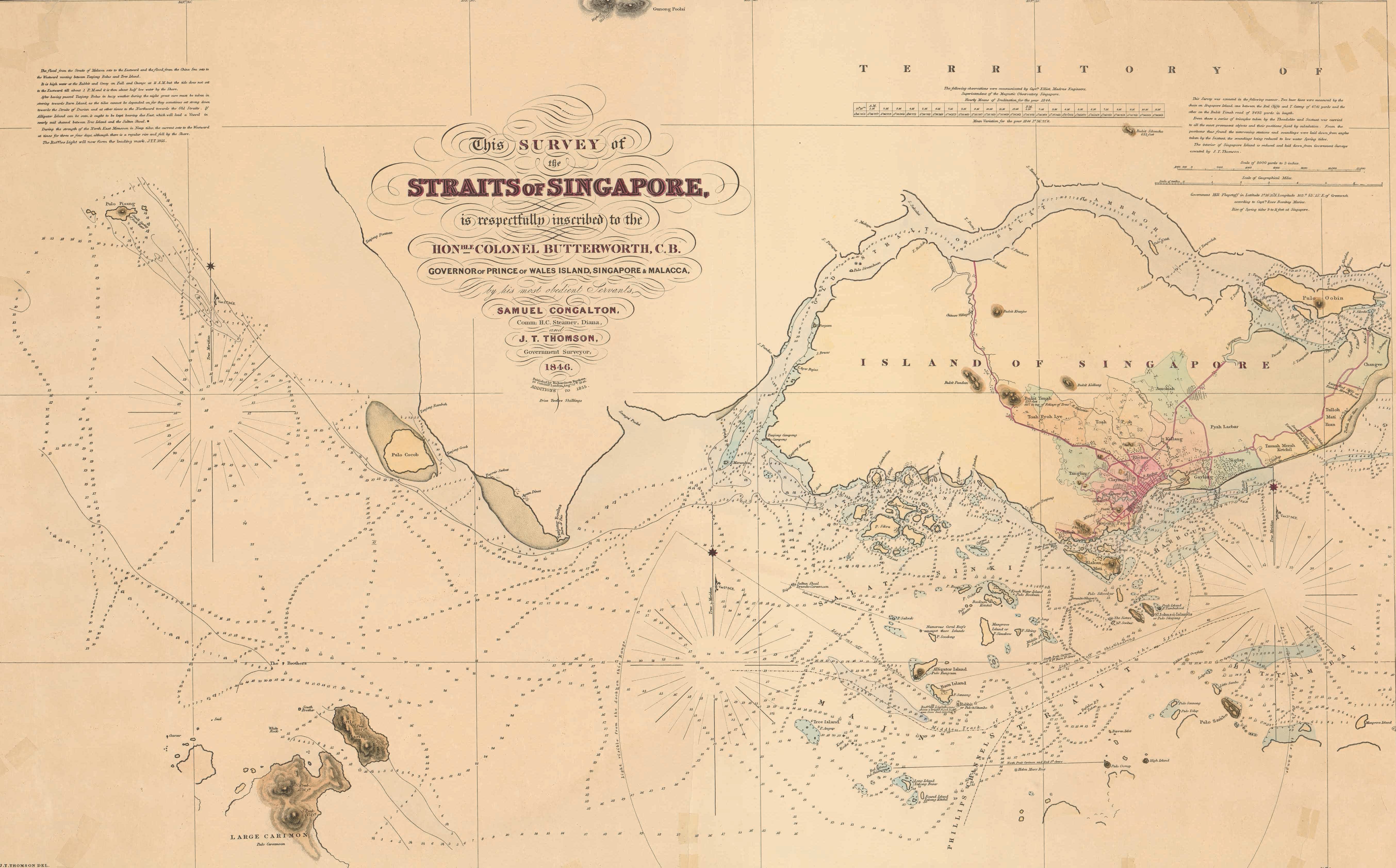
J.T. Thomson’s 1846 Survey Map of the Straits of Singapore showing the western entrance into the straits. Urban Redevelopment Authority, courtesy of National Archives of Singapore.
NAS has about 700 maps from the World War II period (1939–1945), covering the tense years following the outbreak of war in Europe, the battles for Malaya and Singapore, and the Japanese Occupation. Highlights of the collection include British topographical maps of Malaya and Singapore from 1939 that were drafted as part of war preparations. Also of interest are reproduction copies of British and Japanese military maps capturing troop movements during the course of the Malayan and Singapore campaigns, as well as British military planning maps drawn up as part of the Allied effort to recapture Malaya and Singapore. Most of these British military maps were obtained from NAUK and the British Library, while the Japanese maps were either reproduced or acquired from private collections.
NAS has a collection of over 2,200 maps covering the period from the restoration of British rule at the end of World War II to Singapore's emergence as a sovereign republic. A notable development in the cartography of this period is the introduction of aerial photography, which led to the production of Singapore's first aerial maps in the 1940s. Aerial photography replaced traditional trigonometric surveys of the post-war period as it was a much faster and cost effective way of producing accurate topographic maps.6 These aerial photographs are available for viewing in the NAS image database, together with a selection of stitched aerial photomaps of the central parts of Singapore from the NAS map collection.
Political changes saw Singapore transform progressively from a British colony into a self-governing and then independent state, leading to the general election to select representatives to Singapore's legislature in 1948 and the drafting of the first electoral maps. The first urban masterplan maps, which provided comprehensive information of land usage patterns across Singapore, were also published during this period in 1958.7
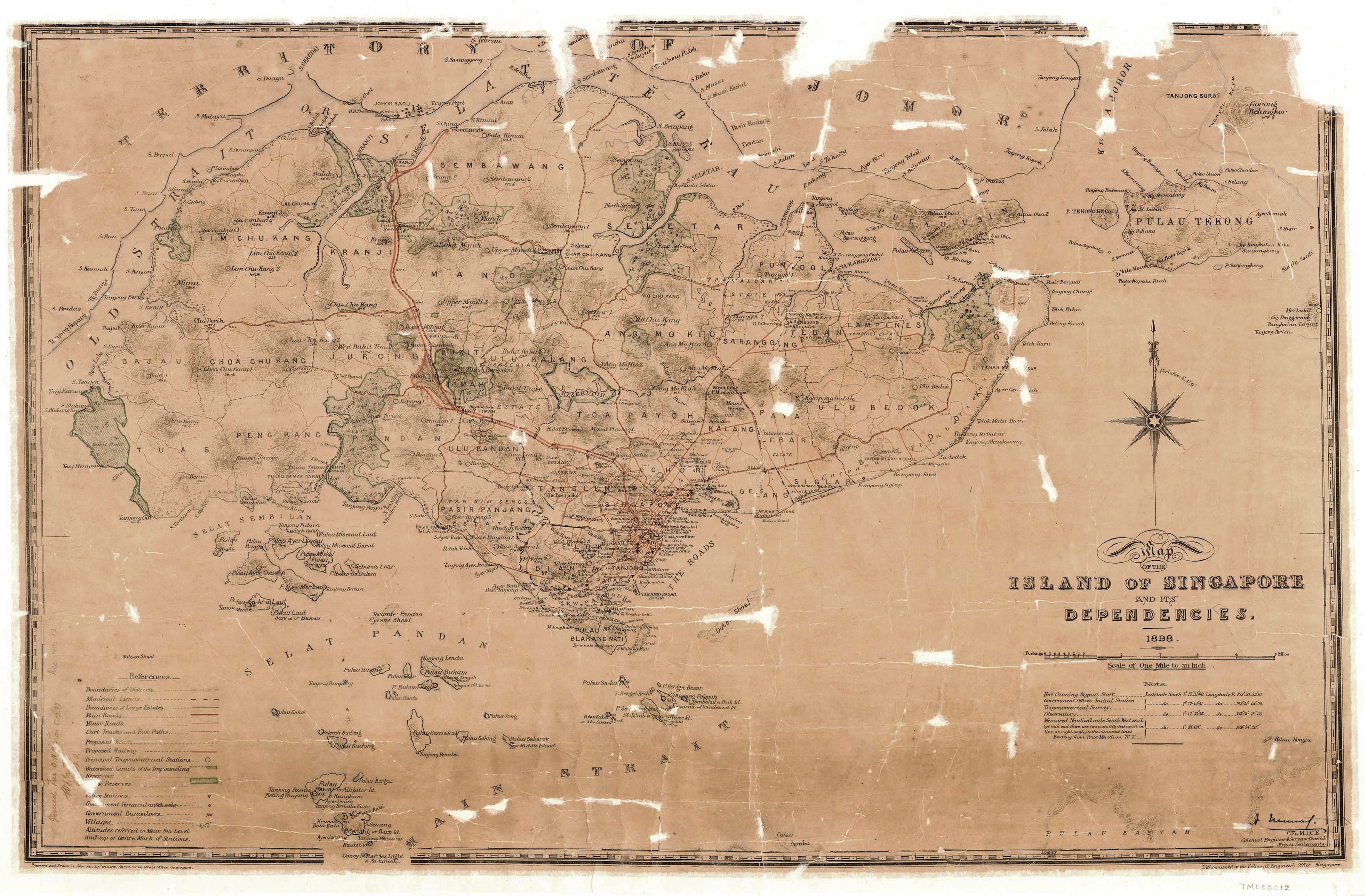
The 1898 “Map of the Island of Singapore and Its Dependencies” is a highly detailed map showing names of major buildings, districts, hills, islands and other landmarks in addition to major transportation arteries around the island at the turn of the 20th century. Survey Department, courtesy of National Archives of Singapore.
Finally, the NAS collection contains about 4,200 maps published between August 1965 and 2009 – the period when Singapore became a sovereign independent Republic to the date of the latest maps deposited with the NAS. Important developments that took place during this time include the establishment of the SAFMU in 1970, which is part of the Ministry of Defence. SAFMU took over responsibility for the nation's topographic mapping, allowing the Survey Department to concentrate on creating cadastral and other survey maps. Notably, in 1971, SAFMU published the first topographic map created under the Republic of Singapore.8
From the 1980s onwards, computerisation and digitisation of mapping emerged as new digital technologies gradually displaced analogue mapping techniques.9 The NAS collection also contains a number of modern hydrographic maps created by the MPA and its predecessor the PSA, the most recent of which was published in 2009.
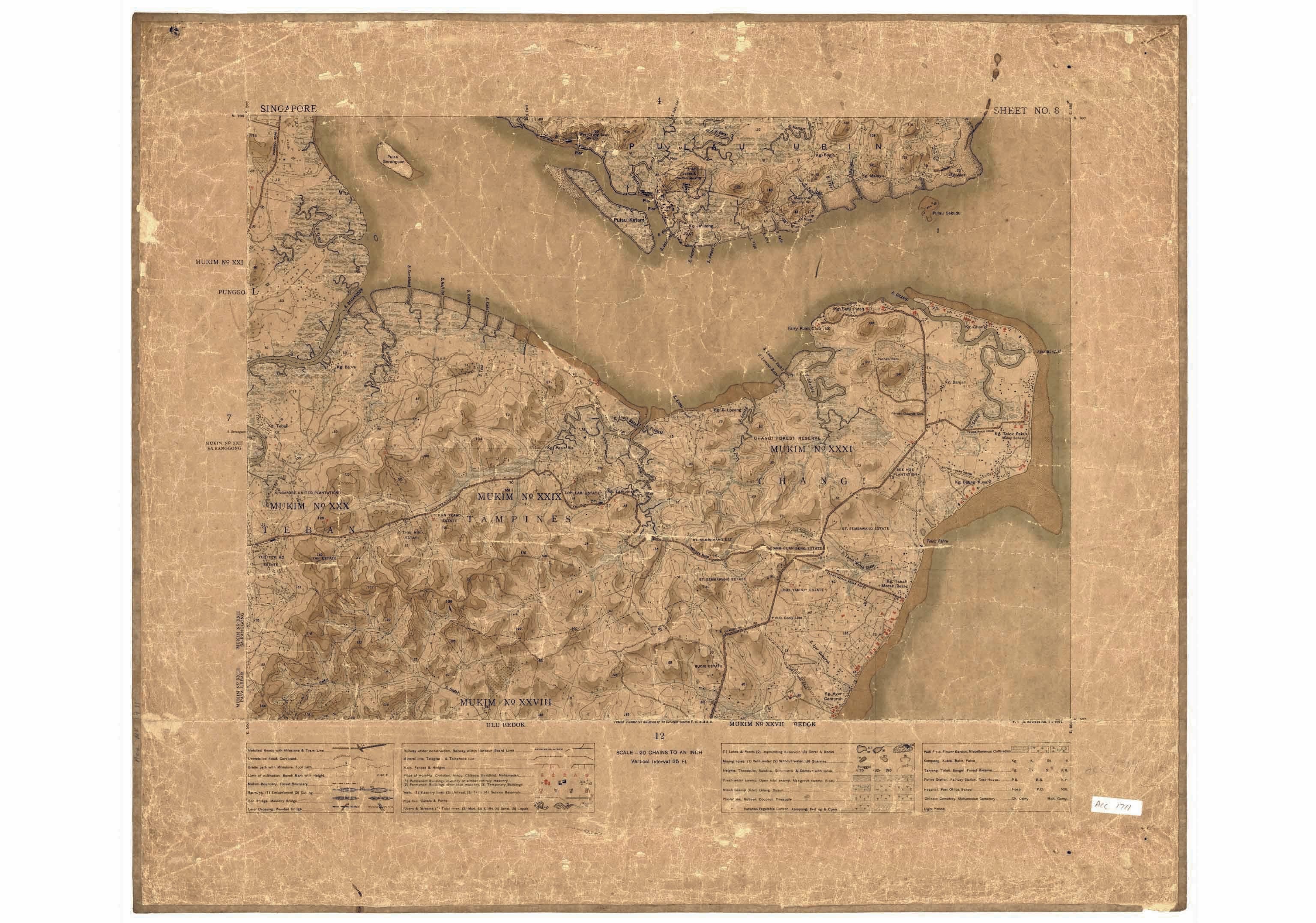
A segment of the 16-part 1924 topograhic map of Singapore island, covering the Tampines, Changi and Punggol regions. Survey Department courtesy of National Archives of Singapore.
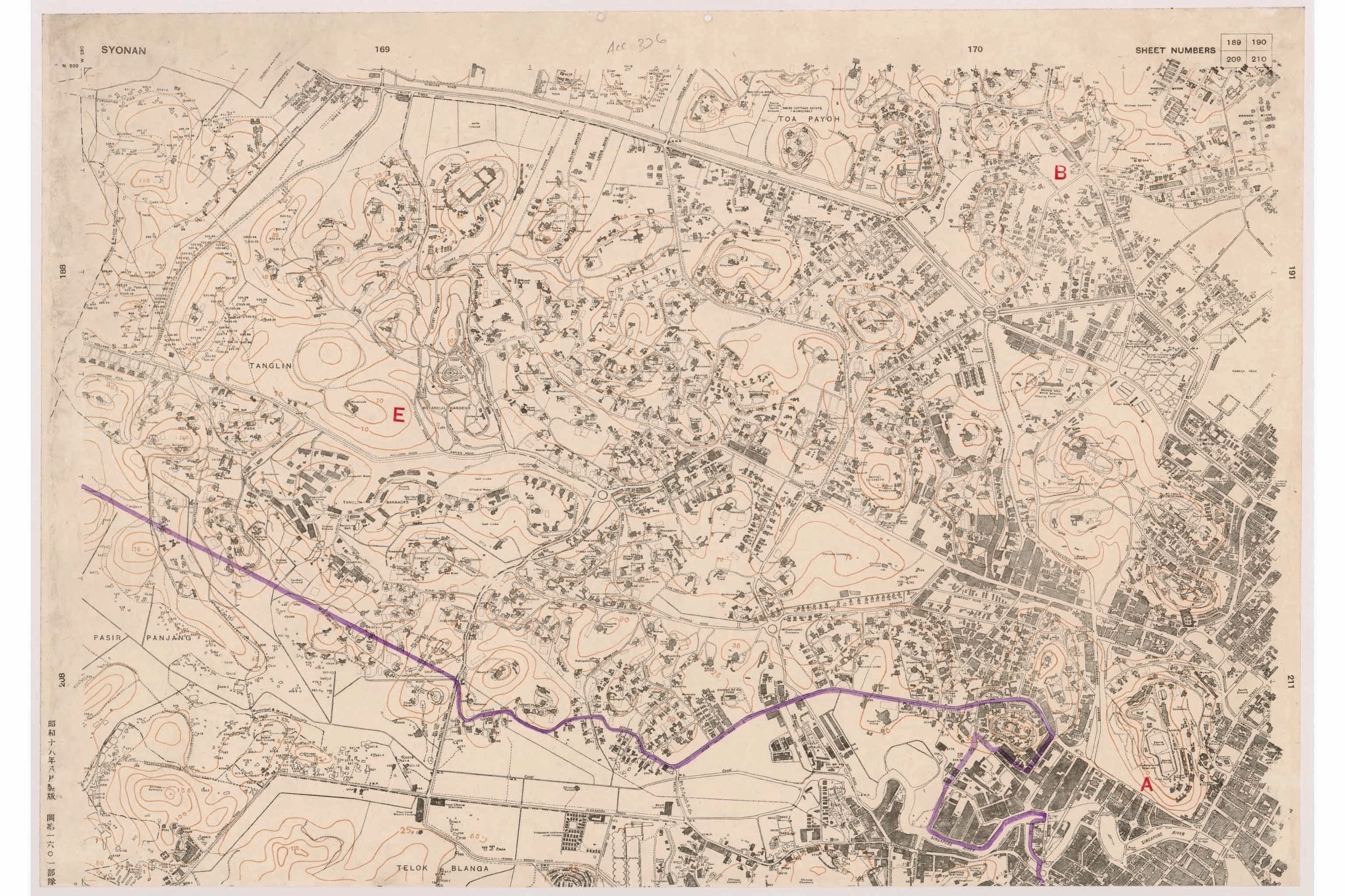
A segment of the Singapore Town Plan series map printed by the Japanese in 1943 during the Occupation. The map is labelled "Syonan” on the top left corner and Japanese inscriptions can be seen on the bottom left corner of the map. Survey Department, courtesy of National Archives of Singapore.
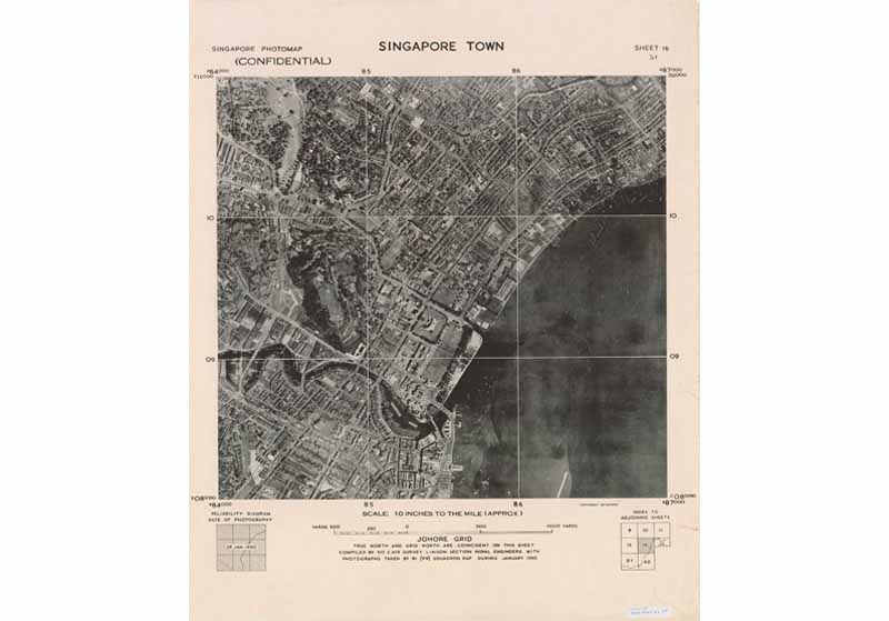
An aerial map of Singapore town, 1950. These maps were made by stitching together aerial photographs taken by the British airforce's 81 squadron, an air reconnaissance unit based at the Seletar and Tengah airbases between 1947 and 1970. Survey Department, courtesy of National Archives of Singapore.
An aerial map of Singapore town, 1950. These maps were made by stitching together aerial photographs taken by the British airforce's 81 squadron, an air reconnaissance unit based at the Seletar and Tengah airbases between 1947 and 1970. Survey Department, courtesy of National Archives of Singapore.
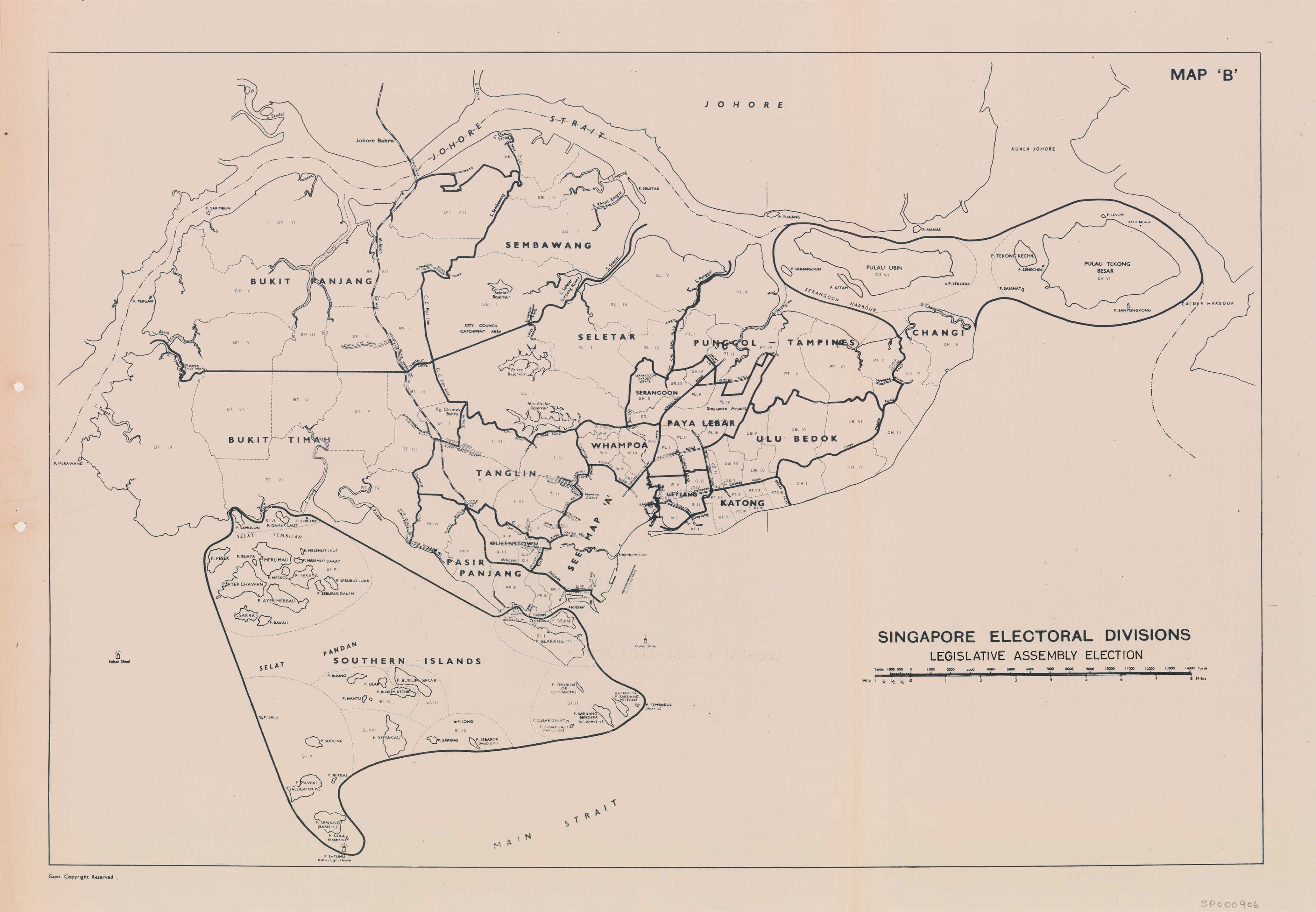
An electoral division map for the 1955 Legislative Assembly general election. This was a landmark event in Singapore's political history in which the majority of members in the governing Legislative Assembly would be elected rather than appointed by British colonial authorities. It set the stage for Singapore's achievement of self-government in 1959. Singapore Land Authority, courtesy of National Archives of Singapore. The National Archives of Singapore Map Collection can be viewed and accessed on its public database Archives Online: http://www.nas.gov.sg/archivesonline/maps_building_plans/
The National Archives of Singapore Map Collection can be viewed and accessed on its public database Archives Online: http://www.nas.gov.sg/archivesonline/maps_building_plans/
The National Archives of Singapore (NAS) is the official custodian of all records of national and historical significance that serve as the corporate and social memory of the Singapore government and its people. NAS holds possibly the largest collection of Singapore maps, numbering around 10,000. These are available to the public and include an extensive collection of survey and topographic maps dating from the British colonial era to modern times.
About the Author
Kevin Khoo is an archivist at the National Archives of Singapore. His interests include cultural and social history, comparative religion, philosophy, literature and poetry, economics and archival science.
Endnotes
1 Robinson, M., Muehrcke, K., & Guptil, S.C. (Eds.). (1995). Elements of cartography (p. 12). New York: John Wiley & Sons. (Call no.: R 526 ELE)
2 Kain, R.J.P. & Baigent, E. (1992). The cadastral map in the service to the state (pp. xvi–xiv). Chicago: University of Chicago Press. (Not available in NLB holdings)
3 The first map which accurately traced the outline of Singapore island emerged around 1822, sketched by Captain James Franklin, a visiting Bengal military surveyor. Detailed maps of the rapidly developing Singapore town as well as hydrographic charts of its surrounding waters also emerged. Notably the work of the first Government Surveyor of the Straits Settlements, John Turnbull Thomson (1841–1855), see Hall-Jones, J., & Hooi, C. (1979). An early surveyor in Singapore: John Turnbull Thomson in Singapore 1841–1853. Singapore: National Museum. (Call no.: RSING 526.90924 THO)
4 Mok, L.Y. (2015). Mapping Singapore: 1819–2014. In Visualising space: Maps of Singapore and the region: Collections from the National Library and National Archives of Singapore. Singapore: National Library Board. Retrieved from BookSG. (Call no.: RSING 911.5957 SIN)
5 Mok, 2015.
6 Mok, 2015.
7 Urban Redevelopment Authority of Singapore. (n.d.). Introduction to masterplan 1958. Retrieved from Urban Redevelopment Authority website.
8 Mok, 2015.
9 Mok, 2015.
References
Hall-Jones, J., & Hooi, C. (1979). An early surveyor in Singapore: John Turnbull Thomson in Singapore 1841–1853. Singapore: National Museum. (Call no.: RSING 526.90924 THO)
Kain, R.J.P. & Baigent, E. (1992). The cadastral map in the service to the state. Chicago: University of Chicago Press. (Not available in NLB holdings)
Mok, L.Y. (2015). Mapping Singapore: 1819–2014. In Visualising space: Maps of Singapore and the region: Collections from the National Library and National Archives of Singapore. Singapore: National Library Board. Retrieved from BookSG. (Call no.: RSING 911.5957 SIN)
Robinson, M., Muehrcke, K., & Guptil, S.C. (Eds.). (1995). Elements of cartography. New York: John Wiley & Sons. (Call no.: R 526 ELE)